ClamVision
We took over a real-time 3D dredge guidance product in 2025 and are systematically reworking it, feature by feature, on a monthly innovation retainer.
- Client
- ClamVision · Sea Sight Survey LLC
- Industry
- Marine Construction / SaaS
- Year
- 2025 – present
- Discipline
- Web application, Mobile application
Objective: Take a proven product to the next level
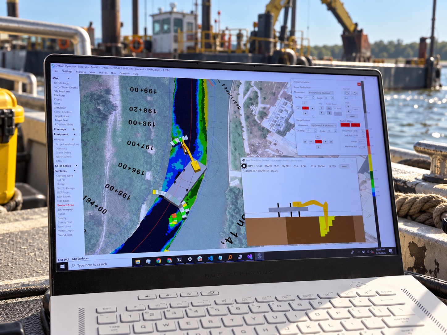
ClamVision is real-time dredge guidance and production software for clamshell and excavator dredging contractors. On a dredge, the operator can’t see the bottom. ClamVision turns sensor data into a live 3D picture of the barge, boom, bucket, and seabed against the design surface, logs every bite, and calculates production volumes as the work happens, so crews hit grade the first time and nobody waits for a post-dredge survey to find out what they moved. It was built by Sea Sight Survey, hydrographic surveyors with more than fifty years of combined experience, and it’s used on projects across the Great Lakes, the East and West Coasts, and the Gulf of Mexico.
Sea Sight Survey sells ClamVision as a SaaS product to dredging contractors. In 2025 they brought in Web Ascender to take over the design, development, and management of the product outright, with a mandate to modernize it systematically and keep innovating.
What Web Ascender Did
Since 2025, Web Ascender has been ClamVision’s product and engineering team. We took over the codebase and have been reworking the application feature by feature, with the biggest investment in more advanced 3D visualization, on a monthly retainer dedicated to making the product better.
What the product does
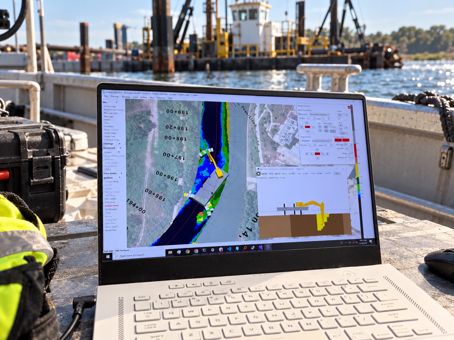
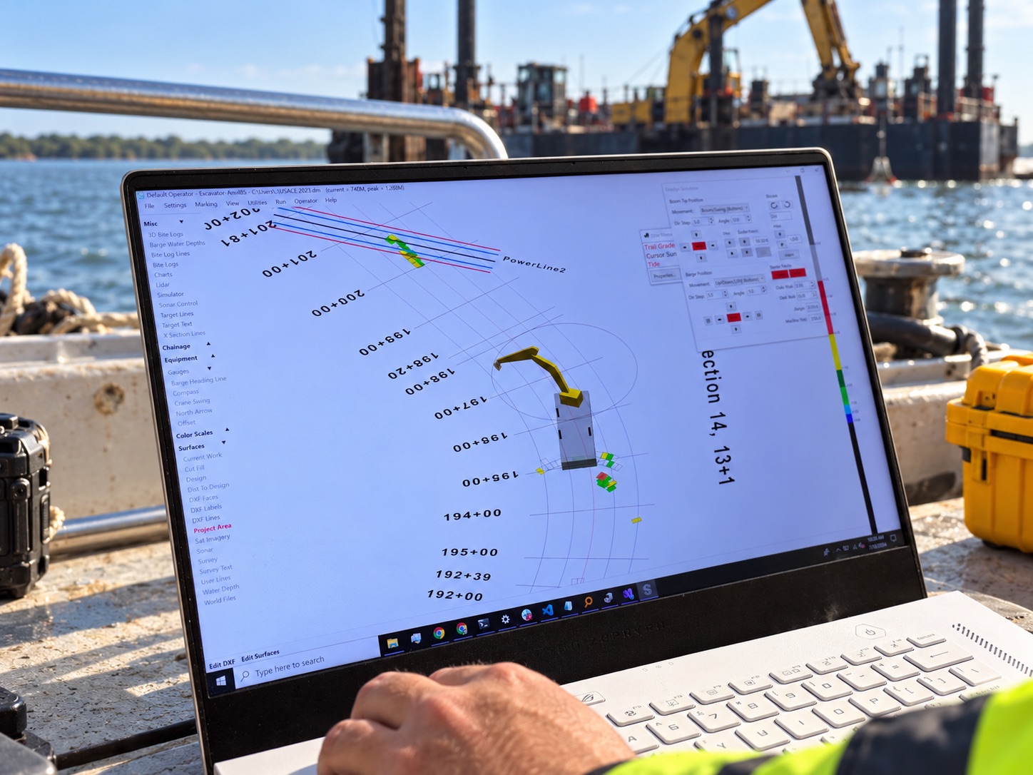
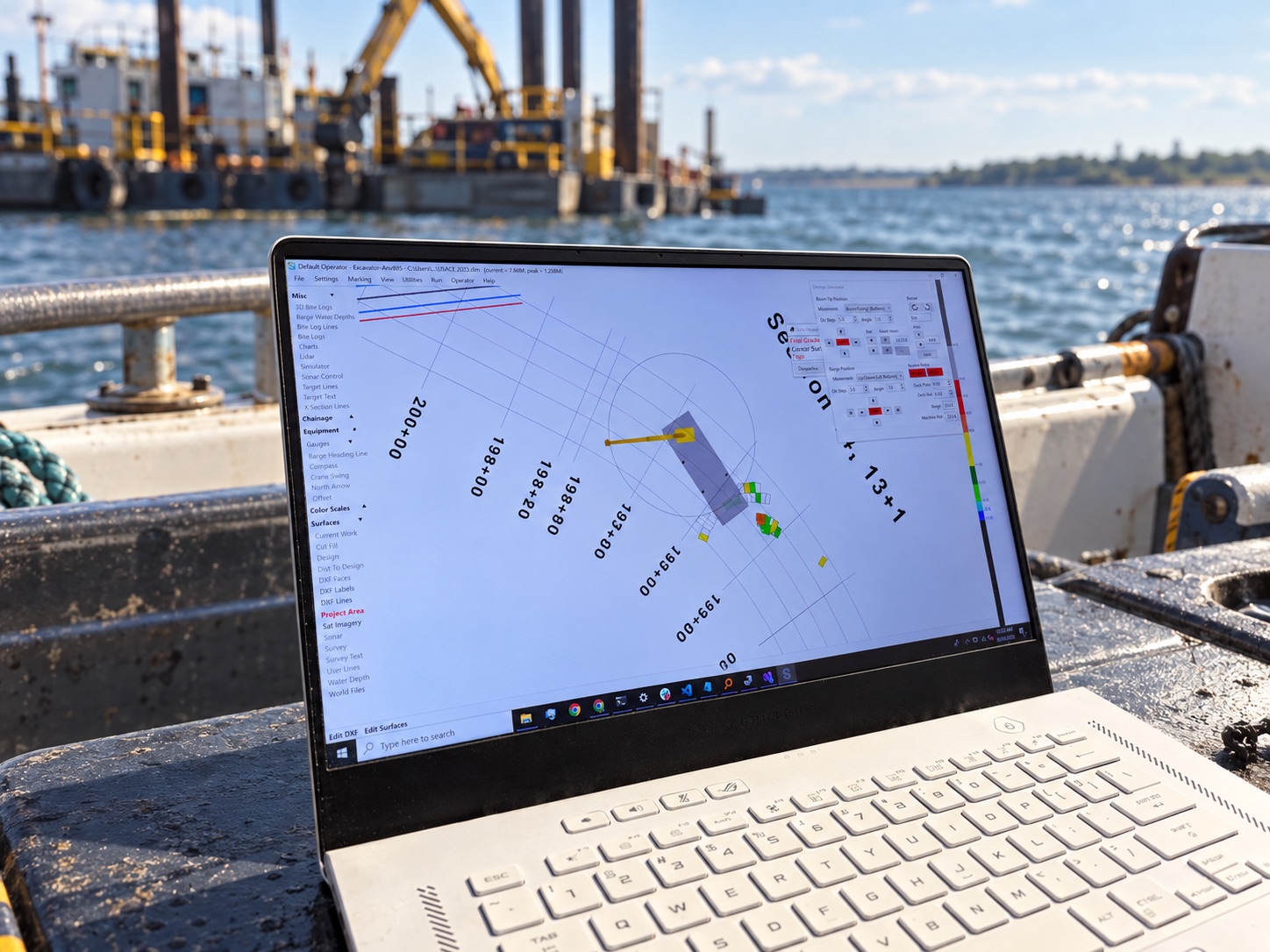
- Real-time 3D guidance - a live model of the barge, boom, and bucket synchronized to the machine, over color-scaled depth surfaces with cross-section profiles that update as the bucket moves
- Clamshell and excavator modes - automatic bite logging for clamshell dredges and a full kinematic model tracking boom, stick, and bucket angles for excavators
- Precision positioning - GPS with RTK corrections, plus chainage-based tracking for pipeline and trench work
- Survey and sonar integration - imports hydrographic surveys in LandXML, DXF, XYZ, Shapefile, KMall, and S7K, and maps the bottom from multibeam point clouds
- Tidal compensation - live gauges and NOAA water level data keep every depth honest
- Defensible production numbers - continuous surface differencing turns every bite into up-to-date volume calculations, with bite heatmaps that flag under-dredged areas
- Reporting and export - PDF, CSV, DXF, Shapefile, and KML outputs built for USACE-style compliance reporting
- Fleet connectivity - multi-vessel management through a relay server and cloud dashboard, with a native Android app for monitoring from anywhere
- 90+ device drivers - R2Sonic, Kongsberg, Teledyne Reson, Applanix, SBG, Valeport, NTRIP RTK, encoders, inclinometers, CAN bus, OPC UA, MQTT, and serial protocols, ready out of the box
What we’re doing with it
- Systematic rework - each feature area is being redesigned and rebuilt in turn, with the operator’s screen and workflow as the starting point
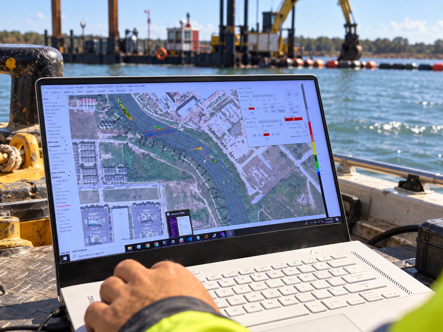
- Advanced 3D visualization - richer equipment models, georeferenced satellite imagery, design lines and chainage stations, and real-time cross-sections, so the operator sees the job the way a surveyor would
- Product management - roadmap, releases, support, and the day-to-day decisions that keep a SaaS product healthy
- A monthly innovation retainer - a standing engagement to keep shipping, so ClamVision keeps pulling ahead of what came before it
The Outcome
ClamVision has a dedicated product team without Sea Sight Survey having to hire one. The software their customers run on the water gets measurably better every month, the 3D guidance is sharper than it has ever been, and the founders can focus on their customers and their surveying expertise while we handle the product.
It’s a model we’re built for: taking over a product with real customers and real revenue, stabilizing it, and then steadily turning it into what it should be.
What we did
- Product Takeover & Modernization
- 3D Visualization
- Software Development
- Ongoing Retainer Development
By the numbers
Want results like these?
Let's talk about what we could build for your business.
Schedule a call →